Bridgforde has three lines devoted to it in the Domesday Book (1086 AD). It was part of Rushcliffe Wapentake and was subject to the jurisdiction of William Peverel. There was enough land for nine families and 12 acres of meadow. No church is mentioned, but there was one at nearby Adbolton.
Bridgford, the West only being added in the 16th century, was thus one of many small settlements set up by the Anglo-Saxons before the Norman conquest. It probably occupied the site it does because of the proximity of Nottingham which was an Anglo-Saxon burgh, or borough, at least as early as 867 AD when the first written reference was made.
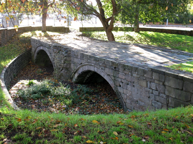 In 924, King Edward the Elder had built a bridge over the river Trent, together with a fortification at its south end. This wooden bridge was the first of a number of such structures. The first traffic island as one crosses over Trent Bridge into West Bridgford contains the last remaining stone arches of the bridge here, which was replaced by a narrower version of the present bridge in 1871. A plaque on the wall at the south west end of Trent Bridge tells of their history.
As one stands here looking at the traffic speeding to Newark and Grantham on the left, and towards Melton and Loughborough on the right, one can see that West Bridgford today, although a sizeable community, witnesses much passing traffic. It has been like this for over 200 years. Although it remained a village of 270 people down to the 1880s, in the 18th century there were three turnpike roads on the sites of the present Radcliffe, Loughborough and Melton roads. The village itself was clustered around the church about half a mile to the south of Trent Bridge.
The houses on Loughborough Road (since demolished and replaced by a Car Sales Showroom and flats) were amongst the first to be built as part of the modern West Bridgford. It had continued to be an agricultural village until 1882 when the Lord of the Manor, Mr John Chaworth Musters, leased and later sold land as building plots. From a population of 293 in 1881 the town rapidly expanded to one of 7,018 in 1901.
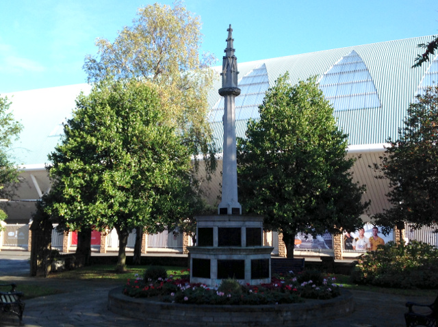 Before proceeding along Bridgford Road, which leads to the site of the original village, note “The World Renowned Trent Bridge Inn”, or TBI as it is usually referred to. There was an inn on this site mentioned in the tithe survey of 1836, then known as the Three Horse-Shoes and Crown. Your walk along Bridgford Road takes you beside the famous Trent Bridge Cricket Ground, opposite the town’s War Memorial. The houses just past Hound Road were also forerunners in the development of the modern West Bridgford.
The railway bridge (part of the embankment is still visible near Millicent Road) over Bridgford Road carried the Midland Railway line to St Pancras Station, London, via Melton Mowbray from 1879 to 1967. In the days of open-top buses, it was necessary for the conductor to mount the stairs just before the bus reached the bridge to warn passengers not to stand up to avoid injuring their heads.
The recently modernised Branch Library on the left was originally opened in 1939, on the former children’s play ground. It contains a special Local Studies section with books of local interest and a large collection of photographs, old and new, of the district.
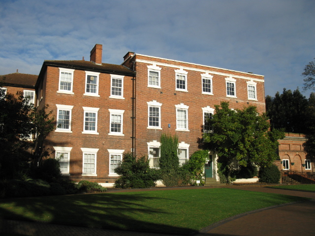 Adjoining the Library is an attractive public park, formerly the grounds of the 18th century mansion, Bridgford Hall. In 1923 the Hall and its grounds were acquired by the former West Bridgford Urban District Council. Prior to that the Heymann family had occupied the Hall since 1840. Lewis Heymann (1802-1869) came to England from Germany in 1834 and quickly built up a successful lace business. The Hall had been erected between 1768 and 1774 for Mundy Musters (1712-1770) who died before it was completed.
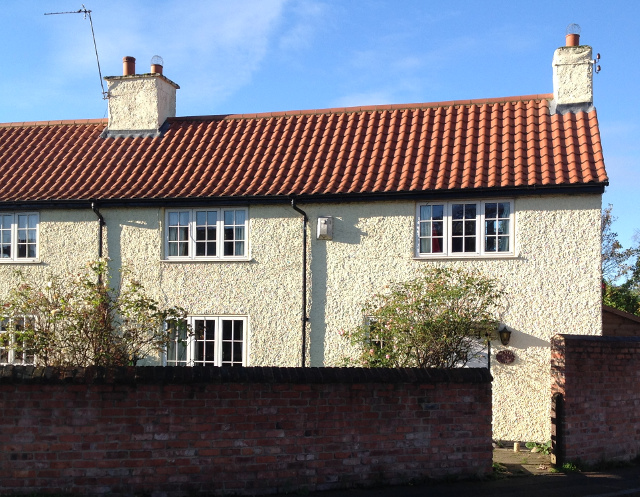
Central Avenue was not created until the 20th century and opposite the park entrance Bridgford Road turns sharply to the right, following the centuries-old route. Clustered round the Church were the farmhouses and cottages which constituted the old village. On the right are a pair of semi-detached houses which date from the early 19th century, one called Thimbleby Cottage after an earlier Lord of the Manor. On Church Drive, bordering the church graveyard, are what are probably the earliest buildings in Bridgford still used as houses.They were build about 1780.
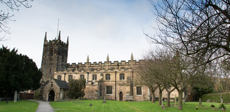 The Church of St Giles is, of course, the oldest building in West Bridgford, parts dating from the 13th century. The earliest known Rector was Luke de Crophill in 1239. If time does not permit going inside, there are a number of interesting features to be seen outside. The west tower dating from the 15th century contains, high up on the south wall, what is probably a dedication stone with the words ‘Christ the stone of help’ in Latin. The stone seats inside the porch would have been used for parish meetings to conduct civil and government matters. On one of the seats is the original stone window from the eastern wall of the old church. Adjoining the porch is the Heymann family grave, and a little further along the south wall of the old chancel is the Rector’s door of about 1230. A new chancel and nave were built in 1896. There are a number of Swithland slate headstones of the 17th-19th centuries alongside the western boundary wall of the churchyard.
 At the end of Church Drive, turn left into Stratford Road and walk to where the road veers to the left. The space opposite, where the Wightman Hall is now to be found, was the Pinfold in the 19th century where stray cattle were impounded. The cottages to the left of the Pinfold, together with one on the corner of Stratford road and Rectory road, are some of the very few older buildings still left. Just opposite is a pair of semi-detached houses which are early 19th century. Also on Rectory road, now forming part of the Conservative Club, is the former master’s house of the National School built in 1865 and used until 1900. At the western end of Rectory road is a group of almshouses erected in 1894 by Mrs Catherine Peatfield, the widow of a curate of West Bridgford.